Zoom Earth is your go-to platform for tracking hurricanes, typhoons, and tropical cyclones in real-time, offering an interactive weather map of the world. With a suite of advanced features, it's designed to keep you informed and prepared for whatever weather comes your way.
Key Features
Satellite Imagery: Zoom Earth provides weather maps enriched with near real-time satellite imagery sourced from NOAA GOES, JMA Himawari, EUMETSAT Meteosat, and NASA's polar-orbiting satellites Aqua and Terra. This gives you a comprehensive view of global weather patterns.
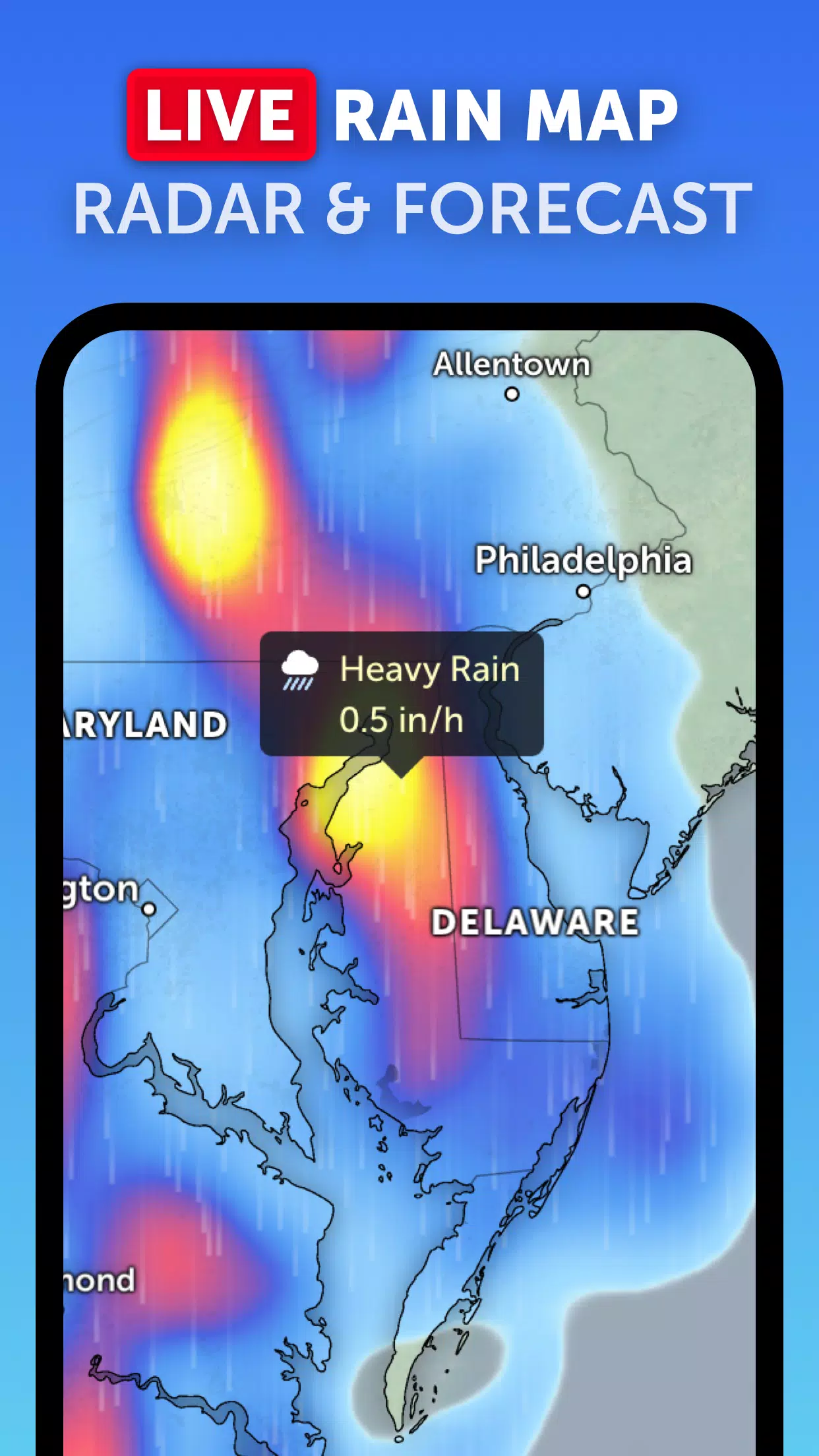
Rain Radar: Stay one step ahead of the storm with our detailed weather radar map. It displays rain and snow detected by ground-based Doppler radar in real-time, helping you anticipate weather changes.
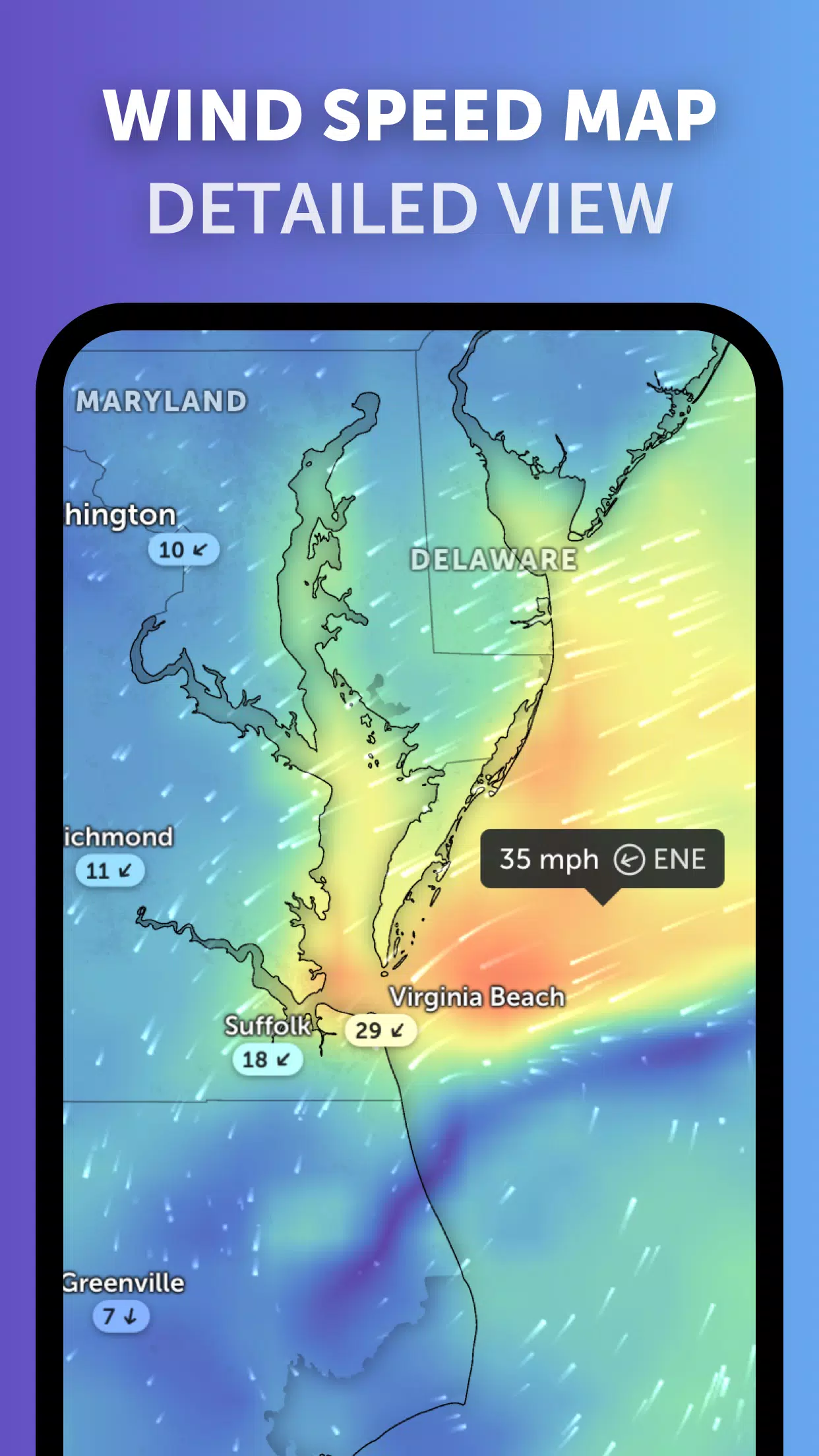
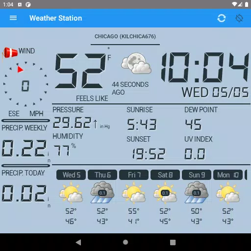
Weather Forecast Maps: Dive into our visually stunning, interactive global forecast maps. These maps cover a wide range of weather data including precipitation, wind speed and gusts, temperature, "feels like" temperature, relative humidity, dew point, and atmospheric pressure forecasts, all designed to give you a clear picture of upcoming weather conditions.
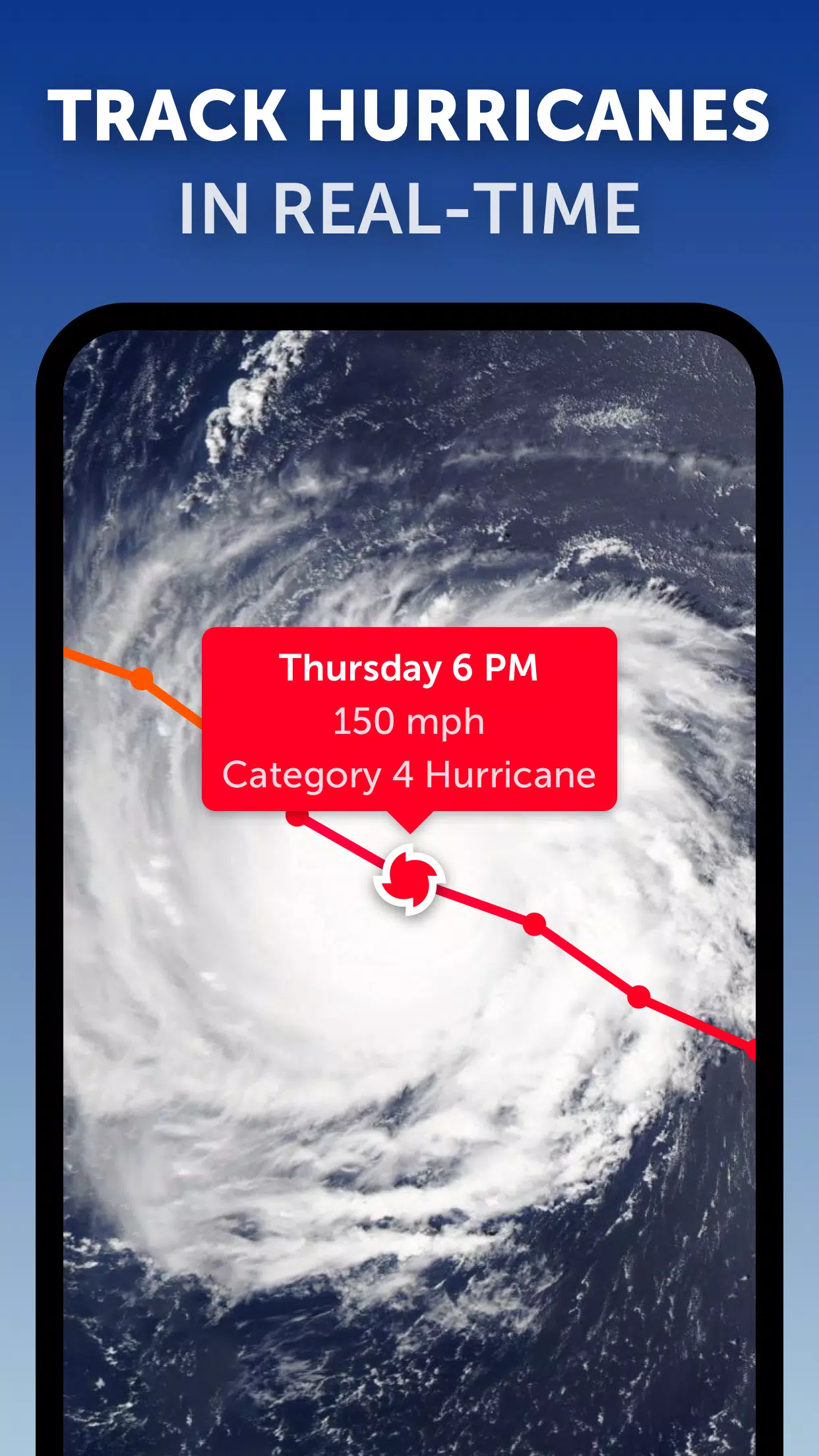
Hurricane Tracking: With Zoom Earth, you can track hurricanes from their inception to their peak as category 5 storms in real-time. Our state-of-the-art tropical tracking system uses the latest data from the National Hurricane Center (NHC), Joint Typhoon Warning Center (JTWC), Naval Research Laboratory (NRL), and the International Best Track Archive for Climate Stewardship (IBTrACS), ensuring you have the most current information at your fingertips.
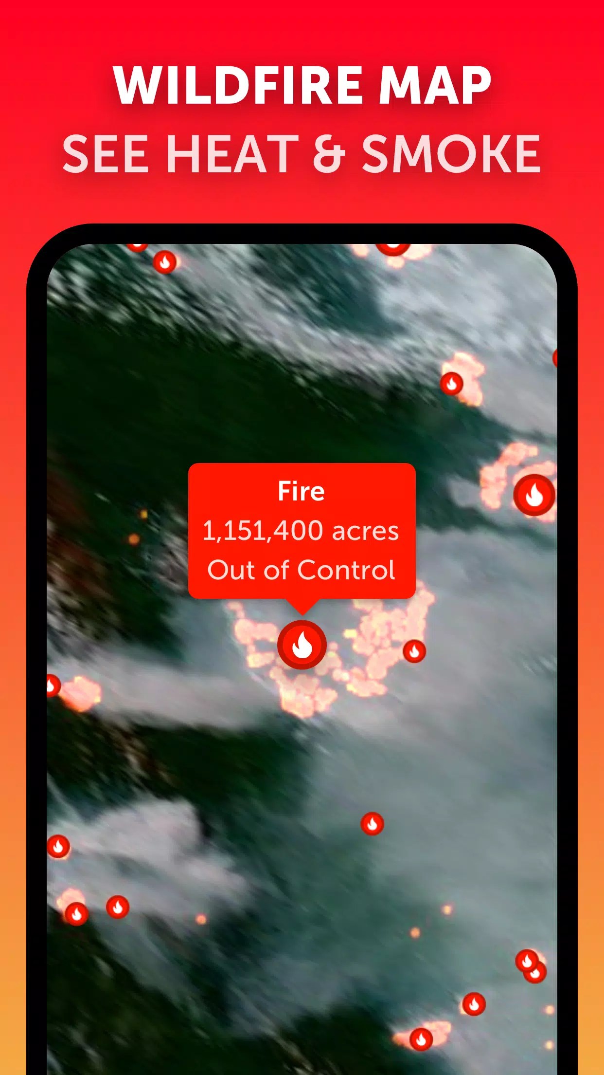
Wildfire Tracking: Keep an eye on wildfires with our active fires and heat spots overlay. This feature shows points of very high temperature detected by satellites, updated daily with data from NASA's Fire Information for Resource Management System (FIRMS), providing critical insights into fire activity.
Customization: Tailor your experience with our comprehensive settings. Adjust temperature units, wind units, time zone, animation styles, and more to fit your preferences and needs.
What's New in Version 3.1
Last updated on Sep 19, 2024
- Enhanced user experience when viewing multiple tropical systems by reducing clutter.
- Introduced separate alerts for Atlantic and Eastern Pacific systems to keep you better informed.
- Improved map labels for clearer and more precise information display.