Discover the power of easy KML/KMZ/GPX management with MAPinr, your go-to GIS solution for measuring, GPS logging, WMS, and offline maps. At MAPinr, we are committed to keeping up with the fast-paced Android version cycles, ensuring our non-profit project remains alive and aligned with our vision of delivering a secure, privacy-friendly, and affordable app.
We understand that Google's minimum Android version requirements can exclude many devices. That's why we offer downloads for versions below Android 14, which are no longer supported by the Play Store, directly on our website.
Are you looking to manage your own points of interest or perhaps visualize your photos on a map? MAPinr is the perfect, ad-free Android app for you. It excels in managing your kml/kmz files and displaying gpx files across a variety of maps. Whether you're a professional or enjoy activities like hiking, cycling, running, or skiing, MAPinr has got you covered.
We value your feedback and ideas for improving MAPinr. Please share your thoughts and suggestions by emailing us at [email protected]. We appreciate your understanding and patience, especially regarding software bugs, as our limited resources mean we can't implement every suggestion immediately.
MAPinr offers an extensive range of features:
- Ad-free experience
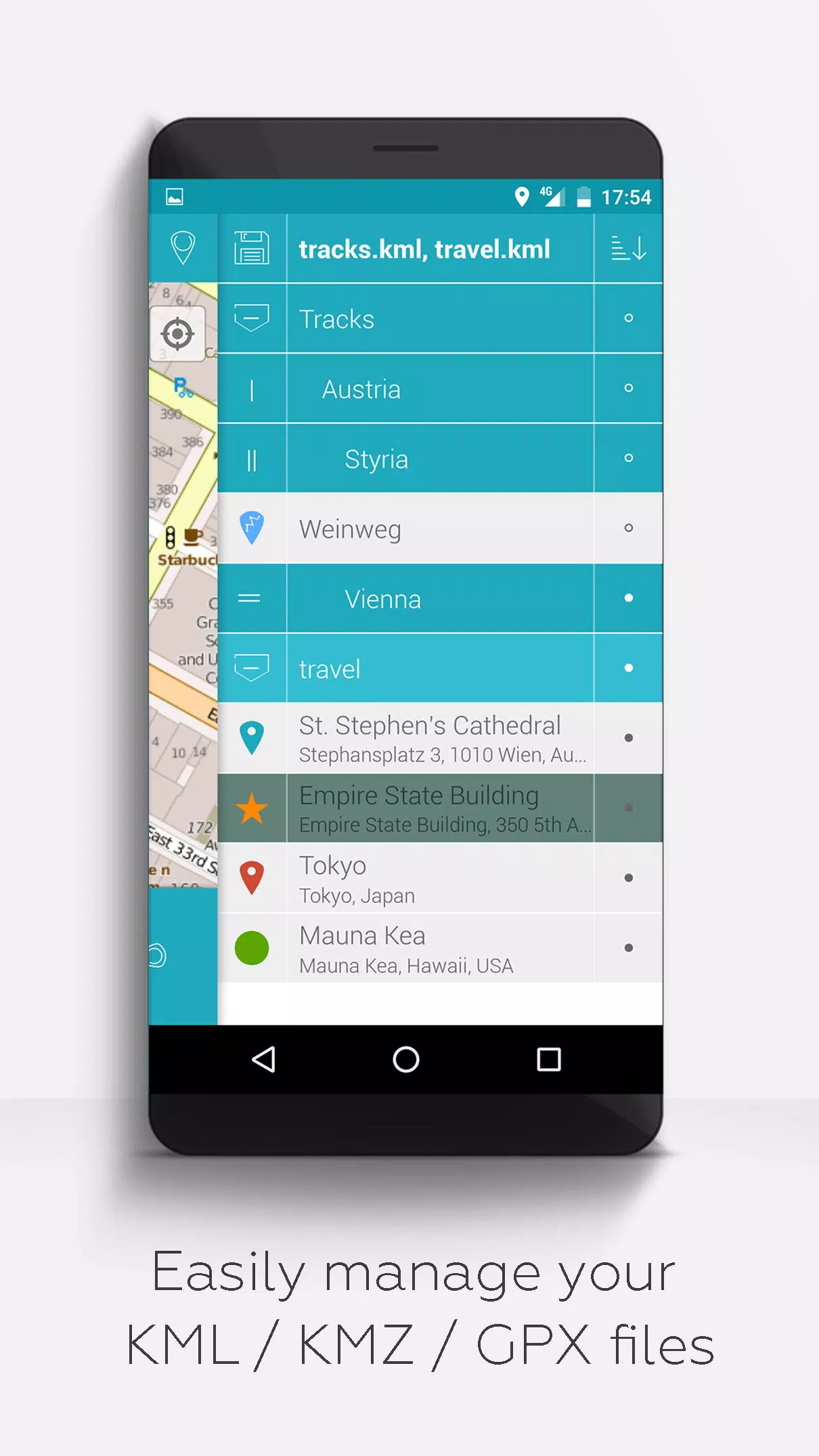
- Hierarchical folder structure for managing multiple kml/kmz/gpx files
- Create, load, edit, save, import, export, and share kml/kmz files
- Create, load, edit, save, import, export, and share waypoints, lines/tracks, and polygons
- Add pictures to your waypoints to create photomaps
- Display waypoints, lines/tracks, and polygons on various maps including Maps, Satellite, Hybrid, OpenStreetMap, Opentopomap, and Opencyclemap
- Share coordinates of waypoints
- Individual colorization of waypoints, lines/tracks, and polygons
- Open exported kml/kmz files in other apps
- Search by name, address, and coordinates
- Location-sharing to keep your friends updated on your whereabouts
- Display multiple kml/kmz/gpx files simultaneously
- Merge kml/kmz files
- Cloud integration
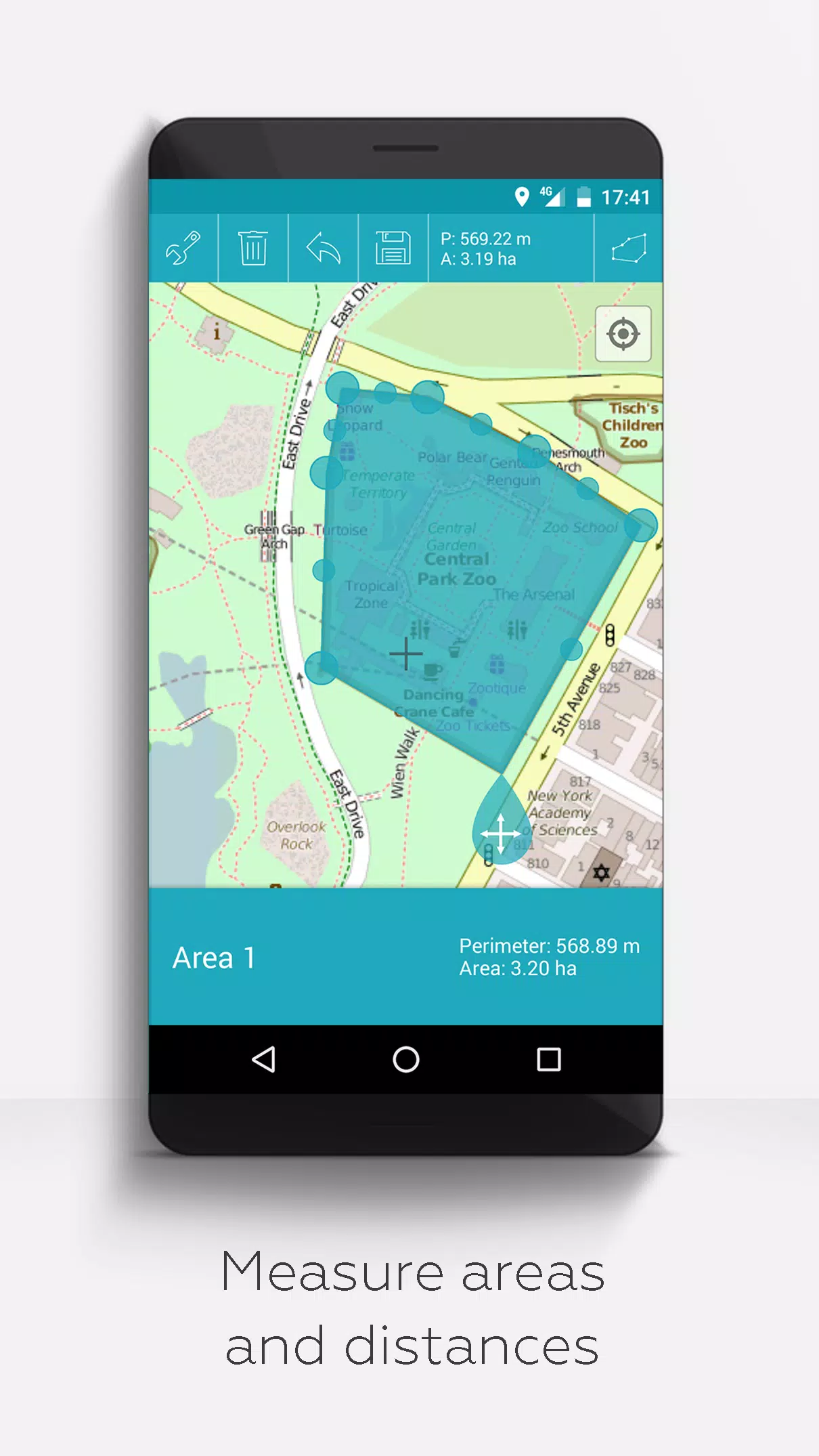
- Measure distances and areas on your map
- Multilingual support (currently English, Spanish, Lithuanian, Polish)
Unlock extended features for free with donations or a LinkedIn like, which can be activated in the settings:
- Download maps for offline use (OpenStreetMap)
- GPX viewer (display only)
- Display arbitrary map data using Web Map Service (WMS), e.g., Opendata from www.data.gov
- Create custom metadata
- Upload and use custom icons
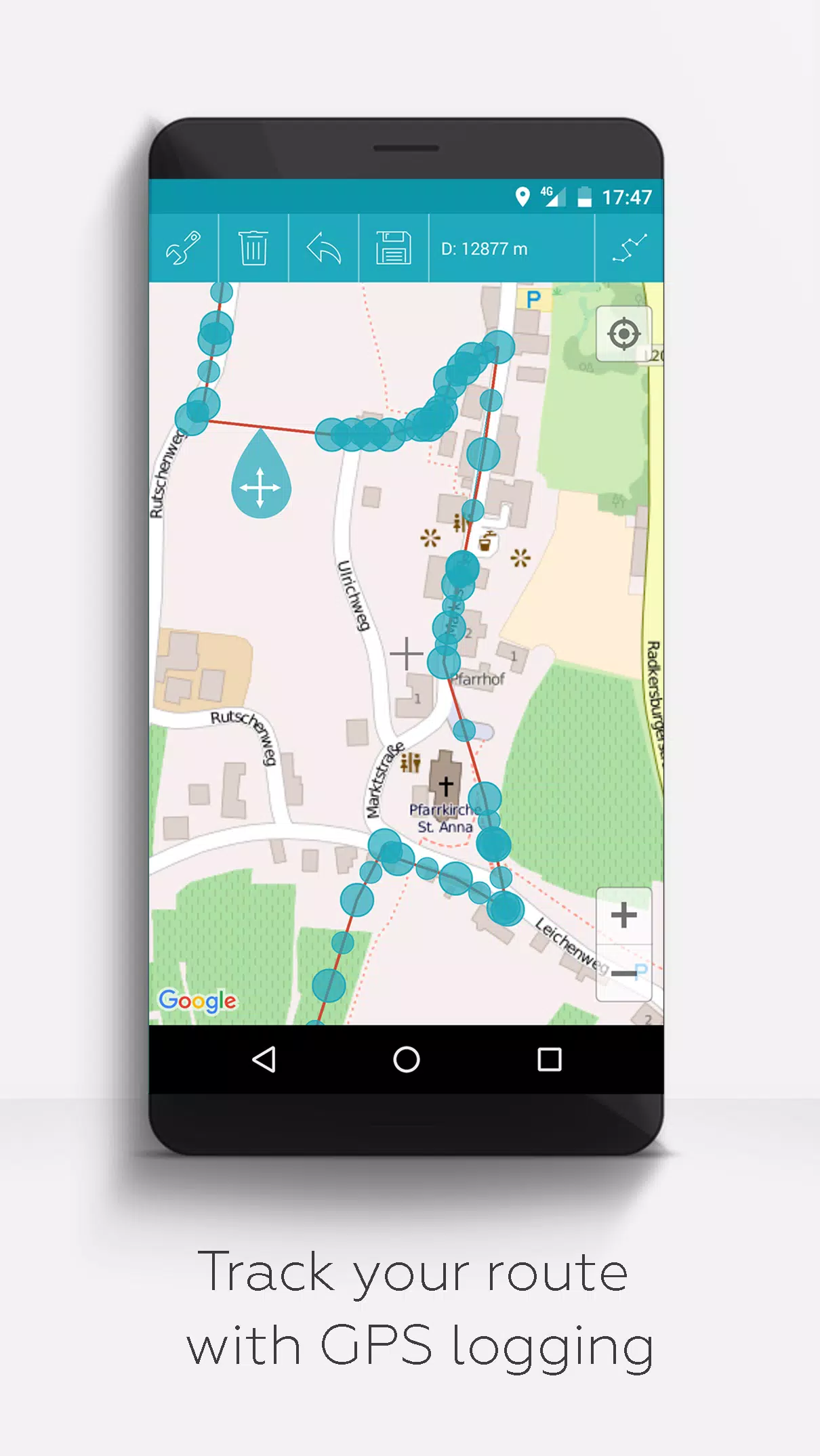
- Record GPS tracks
Unlike related apps, MAPinr respects your privacy and does not collect or sell your data. Donations are a voluntary way to support our non-profit work, helping us continue to provide this valuable service to our users.