City routes, live traffic, transit routes, parking, offline map and navigation.
We're thrilled to announce that we've updated 2GIS! The current version had become challenging to showcase the wealth of information we've gathered about cities and companies. In the new 2GIS, we've revamped the design, introduced a new search feature, enhanced city updates, and seamlessly integrated favorites with 2gis.ru.
Services, addresses, and companies
With 2GIS, you'll discover which service provider serves your home, locate your nearest district hospital or post office, and choose cafes or service centers based on reviews and photos. It also provides opening hours and contact numbers for your convenience.
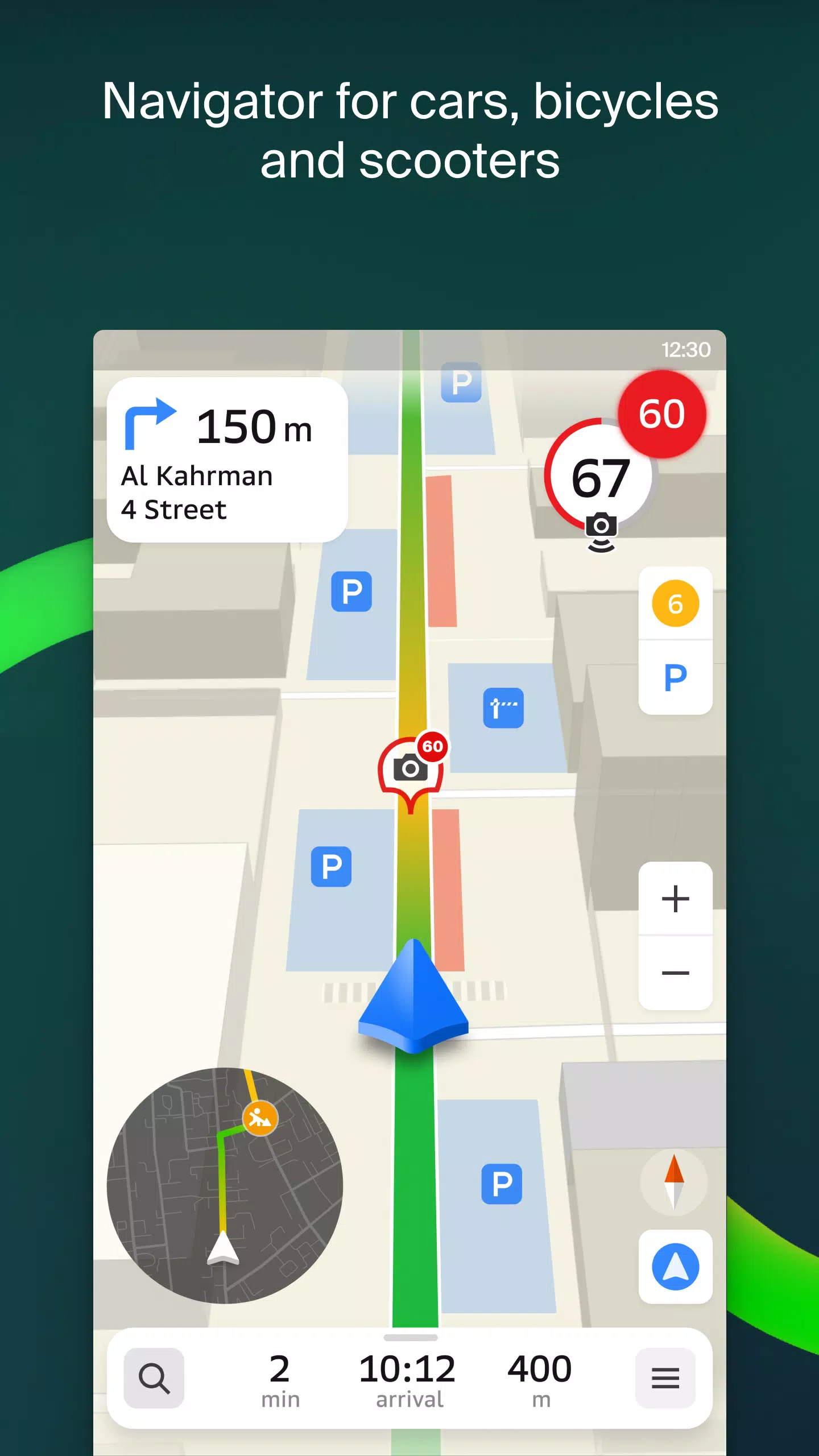
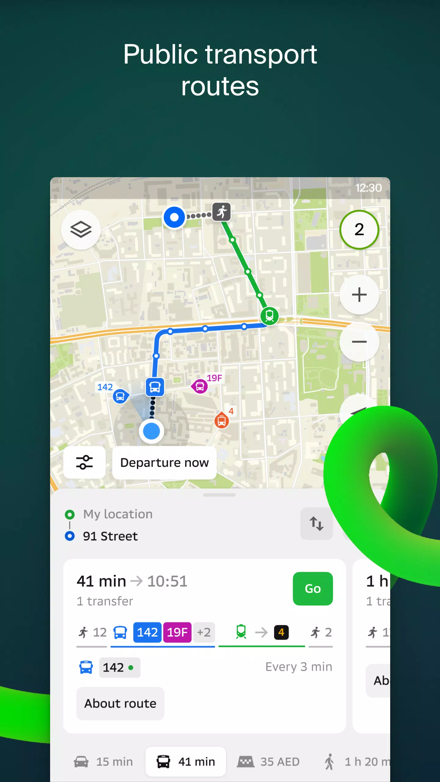
Transport and navigation
For drivers, 2GIS offers real-time navigation with voice instructions, taking into account traffic conditions and roadblocks. It dynamically recalculates routes if you stray from your planned path. For pedestrians, it suggests multiple travel options, including buses, metro, trains, cable cars, and river trams.
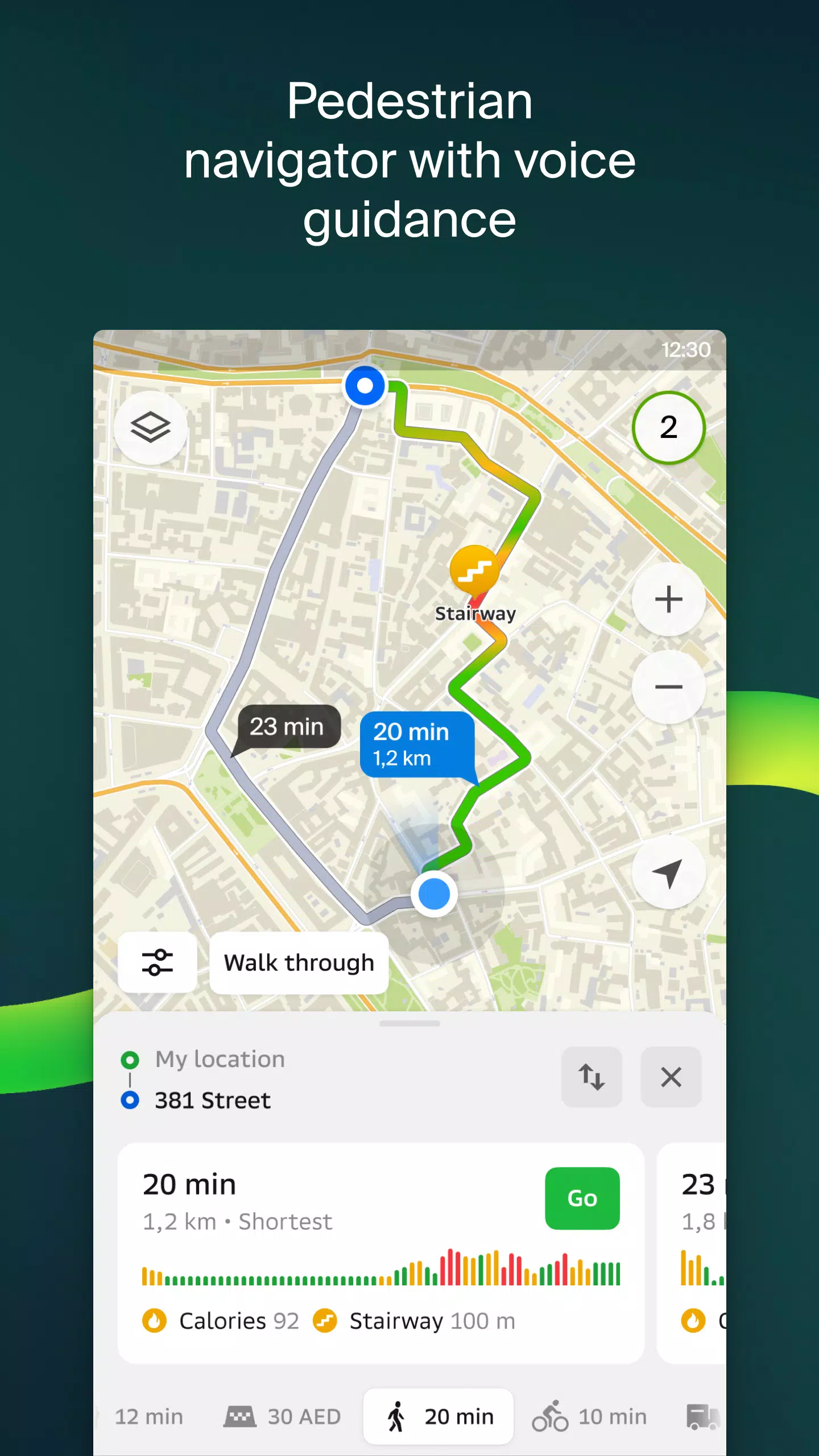
Walking routes
Our pedestrian navigation guides you wherever you can walk, complete with background operation and voice guidance.
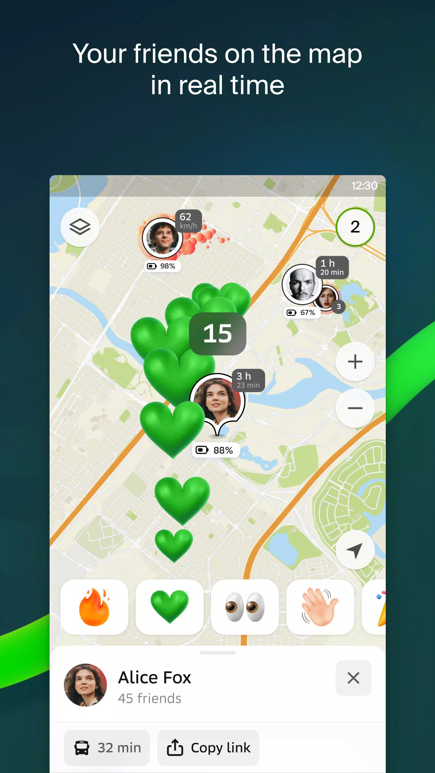
Friends on the map
Now, you can track the real-time location of friends and family on the map! You control who can see your location and who you add as friends, with customizable visibility settings.
Building entrances
No more wandering around to find the right entrance to a business center. 2GIS provides access information for over 2.5 million companies, guiding you directly to the entrance for both public transport and car routes.
Plans of shopping centers
Navigate effortlessly inside shopping centers with 2GIS, which highlights everything from shops and cafes to ATMs and restrooms. Plan your visit in advance to save time.
2GIS beta Notifications companion app for smart watches on Wear OS
We've introduced a companion app for Wear OS smart watches, perfect for navigating on foot, by bike, or using public transport. It syncs with the main 2GIS beta app to show maps, provide maneuver hints, and alert you with vibrations as you approach turns or bus stops. The companion app auto-starts when you begin navigation on your phone and is compatible with Wear OS 3.0 or later.
As a beta tester, you'll receive the latest updates as we fix bugs and enhance features, playing a crucial role in shaping the new 2GIS version that millions will use. You don't need to uninstall the original app; the beta version runs alongside it, allowing you to switch between them at any time.
For support, reach out to us at [email protected].
What's New in the Latest Version 6.44.1.559.3
Last updated on Oct 19, 2024
We've rolled out beautiful, crisp updates designed just for you:
- Enjoy wider, more realistic road displays on the main map and during route searches.
- We're excited to introduce Chats for Friends! Now you can message each other directly on the map.
- Get notified when friends are nearby, with an option to disable this feature in settings.
- Just in time for ski season, we've added ski lift statuses, so you can check if they're operational.
- For public transport routes that involve walking, we now calculate the walking portion in steps.